Think the River Torrens / Karrawirra Pari is the only river in our city? Think again. Read on to find out about some of the other, equally important, rivers across Adelaide – from Field River to Gawler River / Kadlitpari.

While the Torrens might be Adelaide’s most prominent river at more than 460 times the length of Adelaide Oval, it’s certainly not our only one. It might surprise you to know that it’s not even our longest river! (Keep reading to find out which one is.)
There are actually lots of rivers, creeks and watercourses across our region – but here are some of the larger ones that you really need to know about.
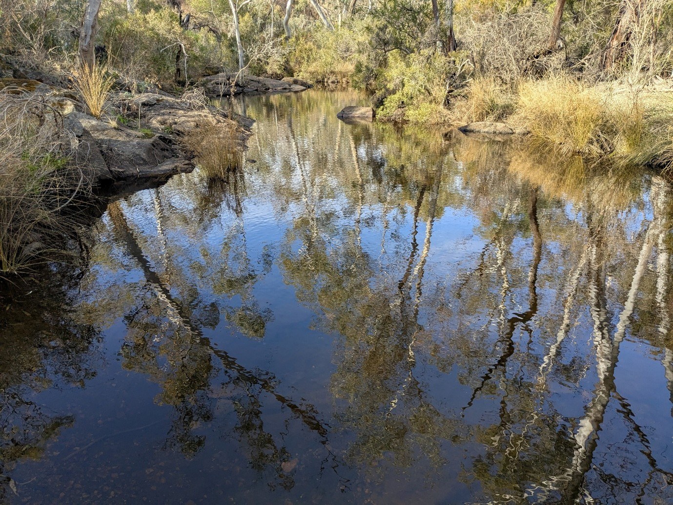
1. South Para River
The South Para River starts near Mount Menge, almost 80 km from the CBD, and flows towards Gawler on the Adelaide Plains, in the north. It eventually meets the North Para River and together they join to become the Gawler River (more on that later).
The entire catchment area is 344 km2 or 34,400 hectares – equivalent to about 22 times the size of the City of Adelaide council area. This catchment is responsible for a significant amount of Adelaide’s water supply, feeding 3 reservoirs – the Warren, South Para and Barossa reservoirs.
Wondering what a catchment is? Essentially an area of land on which rainwater falls and collects.
The South Para River is home to a range of different macroinvertebrates (big water bugs), such as snails, worms and sponges, including some that are rare, sensitive and rely on the flow of water. This is excellent because water bugs are a sign of good water health.
Green Adelaide works with other agencies, such as Northern and Yorke Landscape Board and SA Water to look after the South Para River. One of the ways we do this is through environmental flows – essentially water released from reservoirs to mimic what would naturally happen if there was no human interference, such as damming.
If you want to see the South Para River for yourself, and you’re up for a short and easy hike, you can explore a section on a 3.9 km loop near Mount Crawford.

2. Onkaparinga River / Ngangkiparri or Ngangkiparingga
The Onkaparinga River, known as Ngangkiparri or Ngangkiparingga in the Kaurna language, is 88 km long – making it Adelaide’s longest river!
It runs through Noarlunga and is an important home for flatheaded gudgeon, dwarf flathead gudgeon and shortheaded lamprey. Rare, pouched lamprey have also been seen spotted in this waterway.
The catchment area is a massive 516 km2 – that’s more than double the South Para River catchment and about 36 times the size of the City of Adelaide (council area).
Large sections of the Onkaparinga River are located in the Onkaparinga River recreation and national parks, where you can hike, kayak, mountain bike and picnic.
This is another river where environmental flows are released to help maintain water levels that support the plants, animals and ecosystems more broadly in, around and under the river.

3. Gawler River / Kadlitpari
The South Para River (48 km long) and North Para River (79 km long) join to become the Gawler River at Gawler. The Gawler River then flows for 42 km to the sea at Port Gawler.
The upstream catchments that flow into this river have a combined area of 1000 km2 or 100,000 hectares. If you’re now doing the math – that’s about 64 times the size of the City of Adelaide council area. However, this river doesn’t always have water at every part of it.
Early records about the Gawler River describe it as lush and vibrant, with river red gums, grassy floodplains and lots of native animals. These days, it faces some challenges. Invasive weeds taking over from native plants, a decline in native animals and altered riverbanks are among them.
Despite this, there river and surrounding environment still maintains many important features, such as tree hollows, intermittent river flows and a continuous green corridor from the hills to the coast.
In the river itself, some of the native fish that can be found include common, climbing and mountain galaxias, shortheaded lamprey and western blue-spot goby. Meanwhile, in the skies and trees of the area, you could be lucky enough to spot a variety of raptors, rainbow bee-eaters or the sacred kingfisher.
You can explore some of the Gawler River, along with the North and South Para rivers, on a 10.3 km (one-way) walk around Gawler.
If you live near the Gawler River, find out how your property could play a role in the overall restoration of the river and surrounding area – this could even mean attracting cool native animals to your yard!

4. Sturt River / Warri Parri or Warriparri
The Sturt River begins in Upper Sturt in the Adelaide Hills and flows through the south-western suburbs before meeting the Patawalonga Creek in Glenelg North. When it reaches Bedford Park, it has been converted into a concrete, man-made channel. The Sturt River catchment area extends over 120 km2 and is 27 km long.
The Sturt River has its own Linear Park Trail – it’s about 5 km, from South Road to Anzac Highway, and is accessible to prams, wheelchairs and bikes.
Along the trail, you will find the Living Kaurna Cultural Centre and the Warriaparinga Wetlands where environmental and cultural education programs are offered. This includes learning about the wetlands, which are a series of ponds that diverts and filters water from the Sturt River, before releasing it back.

5. Patawalonga Creek
The Patawalonga Creek, located in Adelaide’s west, is approximately 7 km long and was a tidal estuary prior to European colonisation. That basically just means that it was an area where salty and freshwater mix together.
The best-known part of this system is the Patawalonga Lake – a 1.6 km artificial ribbon lake that runs parallel to the coast, 9 km west of the Adelaide CBD.
The Patawalonga Creek is one of several watercourses that flow into the Patawalonga Lake System (aka the ‘Pat’). The others include the Sturt River, Brownhill Creek and Keswick Creek. The catchment area is more than 230 km2, and mostly from the Sturt River and Brownhill Creek catchments.
This main lake is designed to support a healthy marine environment, while diverting urban stormwater into the Gulf of St Vincent via the Barcoo Outlet. The ‘Pat’– is regularly visited by dolphins on their search for fish to eat.

6. Little Para River
This river’s name draws on the Kaurna word ‘Pari’ – ‘stream of flowing water’ – which you might have noticed in some of the other rivers’ Kaurna names.
It flows from Upper Hermitage, all the way out to the Barker Inlet, where it joins the sea.
Along the river, you can see eucalyptus trees, native wattles and some orange and almond trees from the river’s days supporting the establishment of the citrus industry in the 1850s.
If you’re looking for a relatively lengthy walk that can be fit into one day (apparently!), the 16.5 km one way Little Para River Trail could be a good option… just make sure you plan a way to get back or leave yourself double time to do the round-trip.

7. Field River
Field River is located in the south of Adelaide. It flows from the Mount Lofty Ranges through the southern suburbs of Reynella, Shiedow Park, Trott Park, Happy Valley and Woodcroft and then out to the sea at Hallett Cove.
Along this river you will find Kauwi-marnirla-Field River Conservation Park, a relatively new environmental project involving 55 hectares of land being restored for people and animals – such as threatened yellow-tailed black cockatoos – to enjoy.
Field River Valley is one of Adelaide’s last remaining urban open spaces – few suburbs have an area like this.
To explore a stretch of the river, head on the 5 km one-way Field River Linear Trail from Chandlers Hill Road almost to Main South Road. It’s an easy trek that should only take around 1.5 hours – or 3 hours return.
Field River – the river itself – is home to common galaxias, dwarf flathead gudgeon and congoli, among other fish.

8. Port River
The Port River – officially known as the Port Adelaide River – is located in Adelaide’s west / north-west, around 14 km from the Adelaide CBD.
It starts at the Port Creek, which joins the well-known West Lakes, and flows out to sea at Outer Harbor, after passing Torrens Island.
The Port River is part of the Adelaide Dolphin Sanctuary and so, not surprisingly, is well-known for its resident and visiting dolphins.
Since European colonisation, this river has been used as a shipping channel. But before that it was used by the Kaurna people for food and collecting plant material to make things.
This whole area, which includes an estuary where the freshwater connects with the salt water, is known as Yerta Bulti (or Yertabulti). One study found the estuary alone to have 64 fish species – no wonder the dolphins visit!
Scrap the walking shoes for this river and explore via kayak or paddle board!
Learn more about waterways in Adelaide
Ok, so it’s not our only river but we’re still a really big fan of the River Torrens / Karrawirra Pari. Explore it today.
Interested in how to help look after waterways? Find out about the little things you can do at home to make a big impact.
And finally – discover all the reasons we hate (actually, love!) waterways – from cute animals to clean water.
This blog was originally published on 12 January 2024.